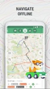
For smart smartphones on all platforms, programs are available that allow you to cut the use of a separate navigation device in your car.
At the same time, each of them can not only lead the car from one point to another but also show traffic jams on the proposed route.
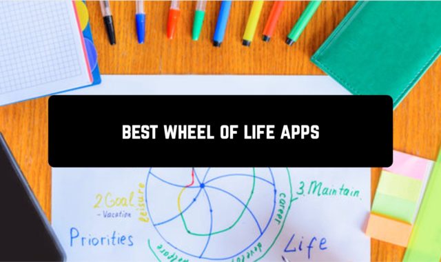
In this review, we have collected the best traffic apps that you should pay attention to.
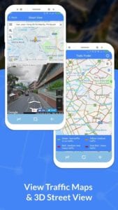
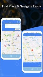
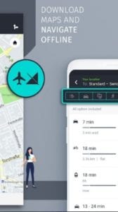
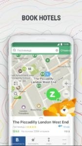
GPS, Maps, Navigate, Traffic & Area Calculating
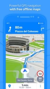
![]() This navigation program is extremely popular among car travelers. It is she who has the best-detailed maps.
This navigation program is extremely popular among car travelers. It is she who has the best-detailed maps.
The program is available for all mobile platforms, its interface has large and convenient buttons.
Among the advantages of this application developers highlight:
- Wide cartographic coverage with high accuracy and detail.
- The ability to select the most appropriate maps from many third-party manufacturers.
- Quick routing (taking into account traffic jams).
- Display of traffic jams by directions and “statistical jams”, calculated in the absence of Internet connection.
- POIs, including dynamic POIs (accidents, tow trucks, etc.).
- Warnings about fixed and mobile speed cameras.
- Smooth scrolling and map scaling as well as 3D objects of urban architecture and 3D junction.
- Easy search, night and day mode support, voice, and visual guidance.
- Displaying the locations of friends on the map, the ability to share locations and messages with other users of the application.
- Free map updates, automatic traffic updates, and a large catalog of POIs.
The first time you launch this application, you’re prompted to select the language of the interface and the voice pack.
You then need to enter your license number or activate your trial period. You also need to accept the standard warning that the application is not safe when you are driving.
The next step is to download the maps. The user can choose between maps from partners, free OpenStreetMap, and paid cards.
Downloads: 10 000 000+
Customers rating:  (4.2 / 5)
![]()
You may also like: 7 Best in-car dash cam apps for Android
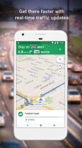
Google Maps
![]() Google navigation is getting better and better.
Google navigation is getting better and better.
On Android devices, Google Maps is definitely faster: both starting the app itself and downloading data.
Google’s map detail is also great. Data – blocked streets, completed bridges, and interchanges – is updated in a timely fashion.
Google is also making progress with traffic jam information: it’s updated fairly quickly.
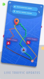
What’s more, it’s much more convenient than competitors to install a useful feature for drivers. Calculating alternative routes to a given goal with traffic jams in mind.
After all, looking at the map of the city decorated with red, yellow, and green colors, it is not always possible to determine the optimal route on the move.
The analyst in this case is just “the right thing”. And here the Google application is on top of it.
Most of the advantages of Google Maps are disclosed on the condition that you are using the app in your “native” environment, ie on a phone with Android.
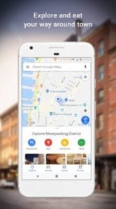
There will be both speeds, and voice management and integration with Google Now. Your smartphone will expect your schedule in advance – and calculate and suggest routes in advance.
Downloads: 5 000 000 000+
Customers rating:  (4.3 / 5)
![]()
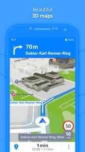
Sygic
![]() This is another serious navigation application, which will be to the taste of those who want to stand out from the crowd.
This is another serious navigation application, which will be to the taste of those who want to stand out from the crowd.
The program is in many ways like Navitel and has a wide range of functions for laying routes, point marks, and so on.
As well as it is necessary to the decent navigator, Sygic is able to do without access to the Internet.
Maps have the highest level of detail and are very well drawn. Not least because of this the program feels more comfortable with productive models of smartphones.
The interface is quite nice. In any case, it does not cause a sense of excessive fancy, although, of course, on the same iPhone “native” Apple cards look more organic.
With one touch you can go to the navigation and add a place in the “favorites”.
You can also go to navigation by tapping the desired location on the map. You can not only navigate to the desired point but also get more information about it. You can also mark a point as an intermediate point.
In Maintenance mode, everything is quite standard. Information about the next maneuver is displayed and there are voice prompts.
In the app settings, you can specify the type of the map (scheme, satellite, folk), turn on/off the 3D mode, display information about road events, switch to the night mode, and select a voice guide.
Downloads: 50 000 000+
Customers rating:  (4.6 / 5)
![]()
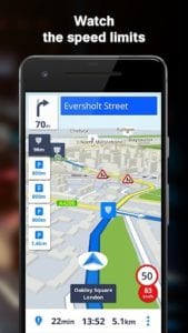
HERE WeGo
![]() Unlike Google Maps, where you can immediately see that they were created as amateur map apps, HERE WeGo is an adult navigation app.
Unlike Google Maps, where you can immediately see that they were created as amateur map apps, HERE WeGo is an adult navigation app.
The program is very easy to use but also very functional. For example, here the user can adjust the default speed limits, which is very convenient.
The current speed and its limit are constantly displayed on your smartphone during navigation. This is convenient, as is a pop-up lane alert.
The application’s main menu item with the same name is used to manage routes. You can view your route as a map, legend, or simulation on the screen.
Besides, you can save your routes in the database and set the alert mode.
Given how badly signs and markups can be seen in a city, this feature is almost instantly addictive for drivers.
Downloads: 10 000 000+
Customers rating: (4.3 / 5)
![]()
Navitel
![]() This is the famous navigation application, which is designed for those who need the largest functionality.
This is the famous navigation application, which is designed for those who need the largest functionality.
In fact, it’s about replacing a separate and complete GPS navigator with a smartphone.
The map in the application has the largest detail, so it’s perfect for those who often drive in the outdoors in unfamiliar places.
Where many other applications show a monotonous flood Navitel displays dirt roads and almost forest paths.
But, in large cities, this advantage disappears as their maps are good for all navigation applications on the market.
The interface at Navitel is difficult for beginners. For example, an audience that chooses an iPhone for the simplicity and convenience of its interface will find the app “not intuitive”.
Downloads: 10 000 000+
Customers rating:  (3.8 / 5)
![]()
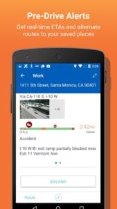
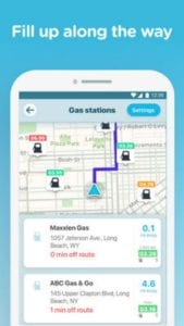
INRIX Traffic Maps & GPS
![]() This application is a de facto standard for many drivers.
This application is a de facto standard for many drivers.
At one time it was thanks to this service that the company broke its way to the top of the navigation applications market.
For several years, even inferior to competitors’ functionality, navigation apps still remained a favorite due to the fact that only they were quite an accurate display of traffic jams in major cities.
The interface elements of this application are quite large, which allows you to manage the application.
Working with this application is comfortable both in landscape and portrait orientation of the device.
You can do this in the application settings:
- configure the maps (select and set display options)
- point of interest display
- traffic information
- add friends from application users
- customize the application
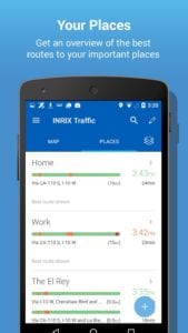
Among the interesting settings, it is worth noting the possibility of manual setting of the device screen size and disabling unnecessary services.
Downloads: 1 000 000+
Customers rating: (3.8 / 5)
![]()
CoPilot GPS
![]() This is a very beautiful 3D map drawing program that takes into account the landscape and the number of floors of buildings.
This is a very beautiful 3D map drawing program that takes into account the landscape and the number of floors of buildings.
It looks great on large screens. It is ideal for those drivers who find space in their car for tablets as a navigation device.
Maps are very easy to navigate, and traffic jams are divided even by lanes.
The picture looks so realistic that sometimes you are afraid to distract yourself from the road to your smartphone so as not to get into an accident.
There’s a side benefit to putting in for excellent speed. Despite the quality graphics, the app without “brakes” works even on phones with mediocre performance.
This application has a very good map, where all the necessary tags are located in a very convenient form.
Even in heavy traffic on the road, you can pay attention to the phone screen and get all the information you need in a second.
Downloads: 5 000 000+
Customers rating:  (3.9 / 5)
![]()
Maps.Me
![]() This is the application, which became a hit, hitting the top 5 ratings of the most popular programs in the category “Travel” – in more than 80 countries.
This is the application, which became a hit, hitting the top 5 ratings of the most popular programs in the category “Travel” – in more than 80 countries.
Maps.Me loses to serious navigation applications, but this program has two unique advantages.
The first is working without the Internet. In other words, you download the map of the area or country you need in advance and then go on the road.
You don’t need a permanent connection to the Internet on the road.
Many other navigation programs for smartphones also offer the possibility of pre-downloading maps. But more often, developers are focused on a permanent connection to the Internet.
This is logical for applications that show traffic jams but become an overabundance on country trips. All the more so because extra mobile traffic on the road is an unnecessary expense.
The second feature of Maps.Me is high map detail. Unlike competitors, the app operates maps with the smallest settlements, the smallest dirt roads.
Downloads: 50 000 000+
Customers rating:  (4.5 / 5)
![]()
Real-time GPS, Maps, Routes, Direction and Traffic
![]() The EasyTRACK app is aimed at motorists and “helps to drive on the freest routes” taking into account traffic jams and traffic events.
The EasyTRACK app is aimed at motorists and “helps to drive on the freest routes” taking into account traffic jams and traffic events.
Besides, the latest version of the app includes a function to check for traffic fines and the ability to pay them quickly.
The interface of this application is not distinctive for its originality.
Externally, it is a typical navigation application designed for use when driving a car.
Among the interesting features of the application, it is worth noting the ability to make the application “look strictly to the north”.
The rest of the main screen elements are standard. There are zoom control buttons, go to the current location, add a traffic event, and search.
Moreover, the search implementation deserves special attention. By default, the application suggests using a voice search. It is more than a logical solution for a car navigation device.
But, no one prevents you from using the classic search, for which you press the eponymous button in the main menu of the application.
In this case, in the search box, you can enter both the address and select the desired point of interest from the directory.
When you select a POI, it will immediately appear on the map, and the detailed information will be displayed when you tap on it.
Downloads: 1 000 000+
Customers rating: (4.3 / 5)
![]()
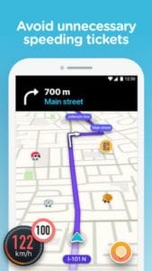
Waze
![]() The Waze app is a special widget that will keep you informed about traffic jams at all times.
The Waze app is a special widget that will keep you informed about traffic jams at all times.
Available sizes of the widget are 1×1, 2×1 and 2×2, and in its settings, you can select the city, time of the update.
As well as points between which to track the traffic situation. Data updates can be performed either automatically (at a certain interval) or manually.
In terms of compatibility, this mobile application is quite versatile.
The maps available in this application are divided by federal districts. And each of the maps received a quality rating from the application developer.
When the application is running, the used map is changed through the application settings menu.
The main screen of this application contains the necessary least information:
- map
- speed data
- map zoom buttons (you can also zoom in with the corresponding multi-touch gesture)
- buttons to send a message to friends, inform about traffic events
- “My Menu” for quick access to some application functions
As its name suggests, this quick access panel can be customized by the user to suit his needs. If desired, you can hide unnecessary buttons from the application setup menu.
Downloads: 100 000 000+
Customers rating: (4.3 / 5)
![]()
You may also like: 9 Best car sharing apps for Android
Offline GPS
 This application receives information about traffic jams using a centralized server.
Each user shares information about the speed of traffic on a particular section by himself. The app does not use simple traffic jams, but vector jams.
That is, when determining the actual speed of flow, its direction at an intersection is used – straight, right, left.
It also uses vector flow statistics depending on the time of day and taking into account holidays and weekends.
Besides, every day the app updates information on blocked roads, restrictions due to repairs, etc.
Routes the application lays convenient and fast, but at times, it still gets into deaf traffic jams. But, the program is constantly being improved, and the more drivers use it, the better it will work.
Downloads: 100 000+
Customers rating: (4.5 / 5)
![]()