
Some people need to know the size of a land lot or the borders of a territory. Here is a list of the best land surveying apps that you can easily install on your smartphone.
By the way, before you start exploring this article, we also recommend you check another one about the best overlay map apps.
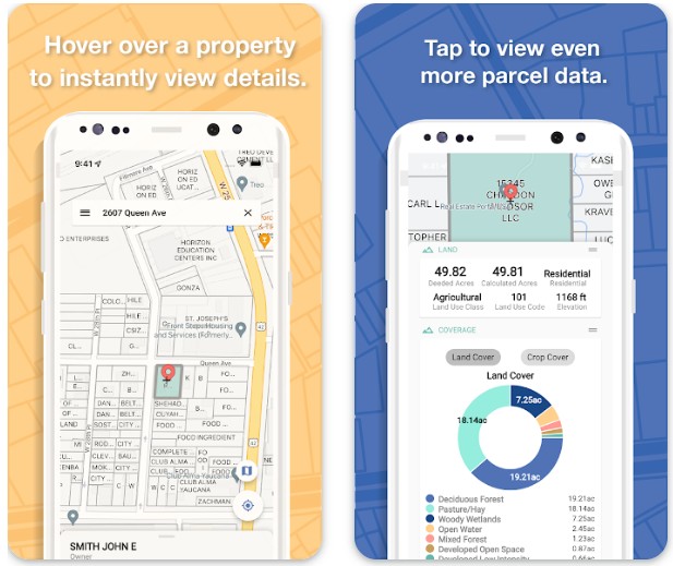
LandGlide
This app is great for those people who often need detailed information about a land lot. It is a perfect tool to work with maps.
Using LandGlide is easy. There is nothing you can get confused about. The developers have made the design minimalistic, so there are no extra functions that would make the app complicated to use.
Download the app to your smartphone and do not forget to activate the location data in the settings.
Access to GPS is essential for the correct functioning of the app. In addition, it will be easier for you too, since you will not have to enter the address into the search bar for a long time.
To get more information about a property, just click on a land parcel right on the map.
However, the features of the app do not break down there. If you have the owner’s details or the number of the land plot, then you will also be able to find this place.
It is unnecessary to know the address to get all the information you are interested in.
After getting all the necessary information, add these areas to the saved ones.
Moreover, users can keep notes about buildings or sites, then return to the app and remember these details, as well as share information with other people using the export function.
Advantages:
- The app uses modern maps of the USA.
- It is possible to get brief info about sites.
- Users can take notes as well as export data.
- It is possible to use the trial version first before buying a full subscription.
Drawbacks:
- The service often does not update information about land plots.
- Users complain that the boundaries of the plots are not shown accurately on the maps.
Downloads: 500 000+
Customers rating:  (4.2 / 5)

You may also like: 9 Best Area Calculator Apps for Android
MadPad GPS Land Surveys
This app will make all the necessary calculations without any issues so that you know all the details about a land plot.
Turn on the GPS on your smartphone and go back to the app. Now that it has access to your location info, it will be easy to find you on the map.
However, if you need a different place, just provide the address or click on the appropriate place on the map.
To find out the size of the diameter, perimeter, or area of the land plot, it is enough to select this place on the map with a few taps on the screen.
In addition, the users also have access to the function to find out the distance from one location to another.
This is very convenient, for example, if you are picking up a house suitable for moving and thinking about options for a route from your home to work or school.
The maps that the app uses are public ones, so information about new places or buildings is always updated.
Advantages:
- It is possible to make various calculations with just a few taps on the screen.
- Information about land plots can be saved and shared with other people.
Drawbacks:
- Outdated app design.
- Users often face difficulties when they purchase a PRO subscription.
Downloads: 500 000+
Customers rating:  (4 / 5)
GIS Surveyor – Land Survey
With the help of this service, users will be able to make calculations very quickly that they need for work or any other purposes.
Of course, you will need GPS enabled on your phone. It is a standard requirement for this type of app. Therefore, feel free to go to the settings and activate this function.
GIS Surveyor is not just an excellent assistant in the exploration of various territories and land plots. You will quickly realize that this is a great tool for working with distant probing of the area.
You do not need to leave your home or office to find out which buildings or constructions are far away from you. All you have to do is install this app, look for the territory you are interested in on the map, and analyze it.
The service offers to try out all the features of a special calculator. For example, the function of calculating the area of a plot is available to you.
In addition, the are many different tools available in the app for professionals who are engaged in surveying land plots.
Advantages:
- Various features are useful for both ordinary people and professionals.
- User-friendly and intuitive design.
- It is possible to use accurate maps that belong to the GIS system.
- There is an offline mode.
Drawbacks:
- The map loads quite slowly.
Downloads: 100 000+
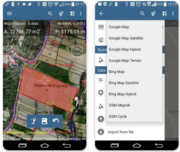
Land Map – GPS Land Survey
This is a modern and convenient service for surveying land plots. If you work as a surveyor, then soon download this app. Here you will find many interesting tools that will make your work easier.
It is possible to collect and analyze data about land plots or territories that belong to buildings, parks, or even forests much faster. Choose the area you want to explore.
Just click a couple of times on the map and you will find the necessary territory. Then specify its boundaries of it. This way you will get all the details – square, diameter, perimeter, and distance.
After the results have been successfully obtained, they should be processed and presented in the form of a document.
To export files with all the collected data, you can use such means as CSV, KML, and GeoJSON. It is also available to save copies on various cloud storage.
Users can choose which map they prefer to work with. The service provides several maps to pick from.
Advantages:
- There are a lot of special features for professional land surveyors.
- The app is simple and clear to use.
- It is possible to choose which map to use for surveying.
Drawbacks:
- Sometimes the app can give errors.
Downloads: 100 000+
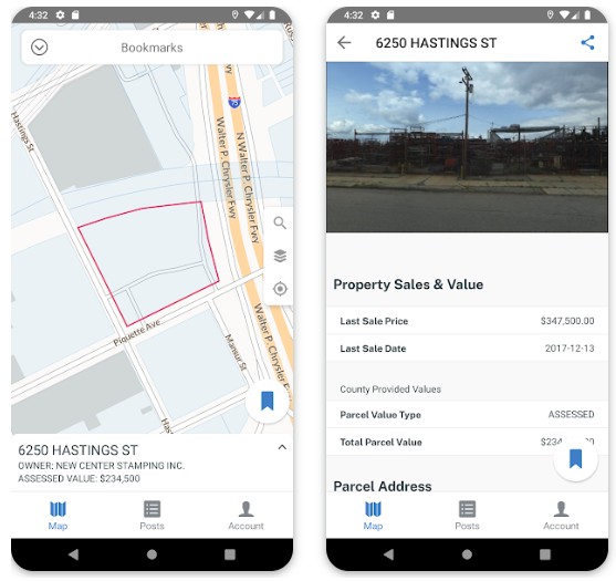
Regrid Parcels & Property Maps
If you want detailed information about a land plot, then this service has it and it is ready to share info with pleasure.
The app has access to almost all US territories. Yes, nearly one hundred percent of buildings and areas are listed in a special register that uses this service. That’s why you are more likely to find what you are looking for.
Write the name of a place in the search bar and you will immediately get all the information about it that Regrid Parcels & Property Maps can offer.
For example, you will find out the price of the plot, the date of sale or purchase, the name of the owner, codes, and much more. This data is sure to be useful for analyzing the landscape.
However, it is possible to find the right place not only with the help of its name and search bar. What if you do not have the exact name of the building that you need to learn about?
In this case, use the map. Just search for a plot of land on the map and click on it to get all the data.
For users the function of adding photos and notes to the territories that you have explored using the app is available. You will quickly appreciate it.
Advantages:
- It is possible to get a variety of information about the object.
- 99% of the US territory is accessible to the service.
Drawbacks:
- The free version of the app has only limited features.
Downloads: 100 000+
You may also like: 7 Best Clinometer Apps for Android
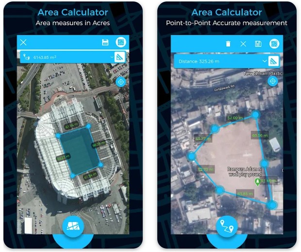
GPS Area Calculator
There is nothing more visual and convenient than a 3D map of the area. This app maintains a complete visualization of the territory, so it can become a new level of comfort for you when surveying land plots.
You can see the building from the top when you select its territory. This way it will be much easier for you to do it since you see the edges.
The service detects the length of borders and distances quickly, that’s why the counting process will only take a couple of seconds.
Of course, you can always save places on the map which you analyzed using the app. Come back at any time to continue your work.
Advantages:
- There is both a regular and a 3D map.
- The service provides a special mode in which users can get all the calculations in the shortest possible time.
- The app has a simple and intuitive design.
Drawbacks:
- There are too many distracting ads.
Downloads: 5 000 000+
Customers rating:  (3.9 / 5)
Area Calculator For Land
This app is perfect for you if your goal is various calculations for surveying land plots. There are all kinds of calculations that users can only need.
After you have decided which territory you would like to measure and found it on the map, you just need to click on the appropriate icon to add a marker. Now create a set of points along the boundaries of the plot.
It is also possible to choose the type of map. Perhaps it will be more convenient for you if it is relief or satellite.
So, when all the preparations have been made, now is the time to start measuring. Perimeter, distance, or square – the service will give you exceptionally correct results for your research.
There are no unnecessary functions in the app – only the most essential for calculating to properly survey the land. Therefore, the design is not filled with useless icons and you will be able to switch between features much faster.
Advantages:
- The service provides accurate results for all types of calculations.
- Users have the option to choose the type of map.
Drawbacks:
- Sometimes the map can show outdated information about a place.

Downloads: 5 000 000+
Customers rating:  (3.3 / 5)
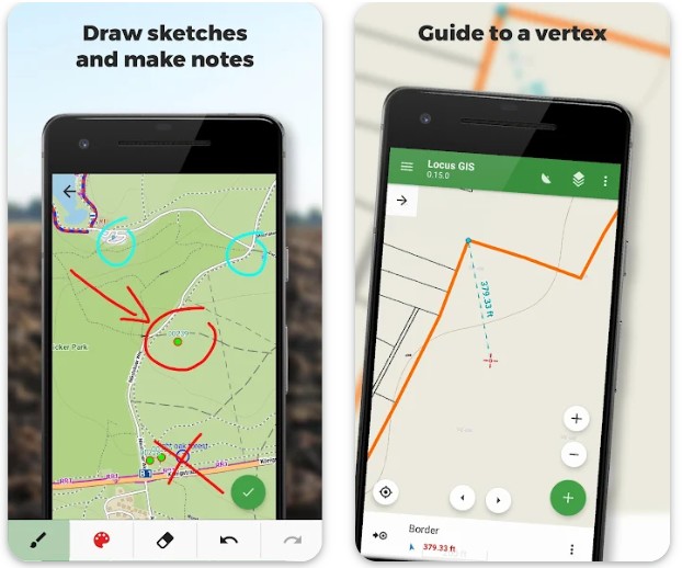
Locus GIS offline land survey
A special feature of this app is that it can work without a network connection. isn’t this convenient? It is not always possible to be online, but you have to keep working or you need information about the land plot no matter what.
However, keep in mind that offline maps take up extra storage on your phone. But not too much. To update the maps, you will still need an Internet connection.
Functions such as land plot data collection and various calculations are also available here.
Locus GIS will become the most useful tool. You can add various information about the research object, edit it and save it. In addition, all the data can be viewed in the form of a table, because it is very convenient for comparing the results.
Another important function of the app is, of course, the possibility to take notes directly on the map. Make sketches in different colors and mark important territories so that you do not forget anything.
Advantages:
- There is an offline mode.
- Users have access to all the necessary calculations for surveying land plots.
- It is available to make sketches on the map.
Drawbacks:
- Sometimes the app freezes.
- When using offline mode, the accuracy of the user’s location is not always correct.
Downloads: 100 000+
Customers rating:  (4.4 / 5)
You may also like: 11 Best Construction Budget Apps for Android
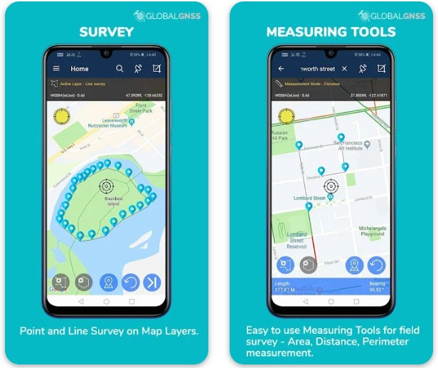
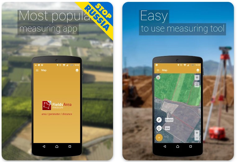
GPS Fields Area Measure
Any territory can be measured and this service will prove to you that this is true. Field, park, urban area – all data will be calculated properly.
The app has a simple design without unnecessary features that would make the users get lost and not understand where they should click to just find out the distance and do their job.
You can try the mode of the quick location of points along the boundaries of the plot to learn more about it. If you put all the points manually, it will take a lot of time. But you can just allow the service to do everything for you.
Besides, you can work with maps and territories as you want. Save, delete, copy, create groups of plots – anything to make your land surveying work much more efficient.
Advantages:
- It is available to quickly place points along the boundaries of the site using a special mod.
- Users can work with a satellite map and see the area as it is in reality.
- The app has all the necessary functions and calculations for surveying land plots.
Drawbacks:
- The app can crash and lag.
Downloads: 10 00 000+
Customers rating:  (4.5 / 5)